Browsed by
Author: stevemichelle

Mudslides, mountains and missing roads!

Mudslides, mountains and missing roads!


Hello!

We are still a bit shocked about the news ( Mocoa devastation ) from Mocoa in Colombia! We were there only 4 weeks ago and are a bit discombobulated by this turn of events especially as we were camped down by the river ourselves.

The situation here in Peru has also been quite discomfiting and seeing the daily news reports of flooding, mudslides, destruction and death puts our safe, tame, easy European existence into stark perspective.

We are now in Caraz in the Cordillera Blanca after a fairly epic journey from Cajamarca.

The town of Cajamarca was a pleasant surprise and so nice we ended up staying three days. Full of locals wandering around in their odd hats, zillions of shops selling cheese – Cajamarca is a major cheese producing region ( we saw milk churns awaiting collection everywhere ) although Peruvian cheese isn’t exactly ( a personal opinion. Some people think it’s excellent ) anything to write or blog home about; a bit rubbery and squeaks when chewed; you could probably make good squash balls with it. –  a great guinea-pig themed bar, pretty colonial streets and a very tranquil hostel with a lovely garden and all at the near perfect altitude of 2700m – although it did rain a bit. Actually, quite a lot of rain but,  this is Peru in the rainy season!

Cajamarca is also where Atahualpa, King of Quito, conqueror of the Incas and his 80,000 strong army, met his untimely and pivotal death at the hands of Fransisco Pizarro with his 169 conquistadors and 69 horses.

Tranquil room next to the hostel garden.
Hats! Apparently, according to a guide, they cost 2000 Peruvian Soles – £500!!! Seems an awful lot for a hat but we gather they’re a treasured possession, a bit like a car, horse or Eastenders box-set! 🙂
Being forced to pose outside our lovely hostel.
Selling milk outside one of the many cheese shops.
Peruvian version of the ubiquitous asian tuk-tuk.
McCuy’s. Guinea-Pig themed bar.
Arty Peruvian beer.
Statue of Atahualpa overlooking Cajamarca.
Knitting! We saw lots of women knitting or hand-spinning wool.
Women hand spinning wool on the go.
Hatted woman and traditional multi-layered dress.
Lots of towns had these collection centres where you could drop off supplies to help those affected by the flooding.
Couldn’t really get a decent photo as it was all roped off but this is supposed to be the room where Atahualpa was held by the Spanish conquistadores before they killed him after promising not to, if he filled the room with gold and silver.

Due to time constraints and trying to deal with the rain/mudslide issues, we took a bus from Cajamarca to Cajabamba where we spent the night. Met a couple of other cycle-tourists here and spent a nice evening drinking beer and talking biking. It’s always nice to talk to other cycling lunatics….  🙂

From Cajabamba we cycled to Huamachuco where we paid a visit to the ruined fortress of Markahuamachuco, one of the most significant archaeological sites in northern Peru yet almost unknown as a place to visit. Sitting at 3600m on a mesa 5 kilometers long and 500 meters wide, with a commanding view of the surroundings, it was probably even more impressive than Kuelap to visit.

Tourist posing…
Big rock, little rock, tiny pebble. The builders of the fortress used this visually pleasing style of construction.
We loved this doorway and its commanding view.
Another great doorway.
Great location.

Many of the buildings are defensively built with double or even triple walls.
and the rain headed our way…..

On the way to Huamachuco we spotted these people hiding in the bottom of a gully making chicha.

After Huamachuco, we took another couple of buses ( saving 2 or 3 days of cycling ) to the hamlet of Angasmarca where we hoped to get a bus to Pallasca ( saving a couple more days of our remaining 2 weeks ) and then cycle from there to Huaraz and the Cordillera Blanca via the Canon del Pato.

However, we discovered in Angasmarca, that no transport appeared to be heading to Pallasca so we decided to cycle. Several blogs said that the scenery was spectacular and the significant climbs were paved and not too steep. The official government website showing current rain-related road closures, had previously reported that the road was closed but no longer did and the people we spoke to only mentioned partial blockages. Some of the above was true, some of it really wasn’t!

Interesting method of road repair.
Three smiling boys and their chickens.
!
Discussing netted chicken prices.
Riding into an empty no horse town.
Crossing the first mud slide on the way to Pallasca.
The second mud/rock slide encounter. Feeling somewhat nervous here.
On the way to Pallasca – looking back at the stunning scenery, windy descent and equally twisty climb.
At the bottom of the climb to Pallasca. The people we spoke to said that the blocked roads were impassable to vehicles but bikes should be OK,  so we ignored the sign and carried on.
Yet another cycle friendly blockage.
Shortly before we got here, a donkey-riding woman said that the road had gone – at least that’s what we thought she might have said. She wasn’t exaggerating!
Now we knew why there was a road closed sign! We were definitely very, very nervous here. Another person we met said it was possible to get through with a donkey so we should be ok! Some of those boulders were as big as a house. Why the people we spoke to in Angasmarca didn’t mention this slight impediment to travel we have no idea. The man we spoke to said that it had been like this for 15 days! We both got our boots full of water crossing this – the current was strong, the water deep and the mountainside above us looked scarily unstable.
It was only after we crossed the mini-ravine and were pushing/heaving the bikes along a muddy track that skirted the missing road, that we realised that there was nothing supporting the remnant of road we’d been inching along!
Another section of collapsed road that we had to scramble our bikes around.

By the time we made it back to the undamaged road we were wet, cold, exhausted and still 7km away from Pallasca with 500m of climbing to do. Fortunately, some electrical engineers were happy to give us a lift in their truck.

Pallasca sits at 3600m and was cold, damp and pretty miserable. The 2-star hotel was closed so we had to plump for a very basic room in a £4 a night hospedaje.

Making tea on our petrol stove on the floor of our room in the Pallasca Hilton.
Completely safe electric shower in the Hilton.

The following morning we made porridge on our stove in the room and left our non-luxurious accommodation.

There are two roads out of Pallasca. One is a 130km up and down mountainous road that may or not be paved. The other, a tarmac surfaced 80km,  2400m descent through a canyon. We were told that the latter had a few issues and was closed to vehicles but that we should be ok to get through with the bikes. Decision made!

As we left Pallasca the views were stunning.
A few small rocks scattered on the tarmac and views to die for…. Nearly!
Bloodstained and covered in mud after our first encounter with a live mudslide! Gloopy, viscous mud and sharp rocks up to Steve’s knees. We struggled to haul the bikes though it. A few minutes prior to this, a rock the size of a fridge smashed down 6 feet away from us! – needless to say, we didn’t stop to take photographs!

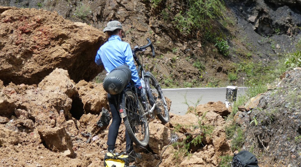
Things continued to deteriorate! The following photos simply don’t capture how big the swathe of destruction was. We had to unload the bikes and literally haul and drag them across 500m of unstable rock, mud, boulders and torrents of water with the whole precarious mountainside looming above us; then go back for the panniers and do it again! Really fucking scary! Well, we did come here for an adventure!

On the approach to Mordor.
A local who was also braving the annihilated mountainside decided to help us. You can just make out Michelle ( right mouse-click and select “open in a new tab” or download, to see the image full size ) in her blue top in the background for some idea of the size of the landslide.
Michelle nearly there with her bike – only a 200m or so to go. You need to do the “right mouse-click and select “open in a new tab” or download” thing again to see her….. Sorry to make you do geek stuff! :p
Wouldn’t want to do that again!

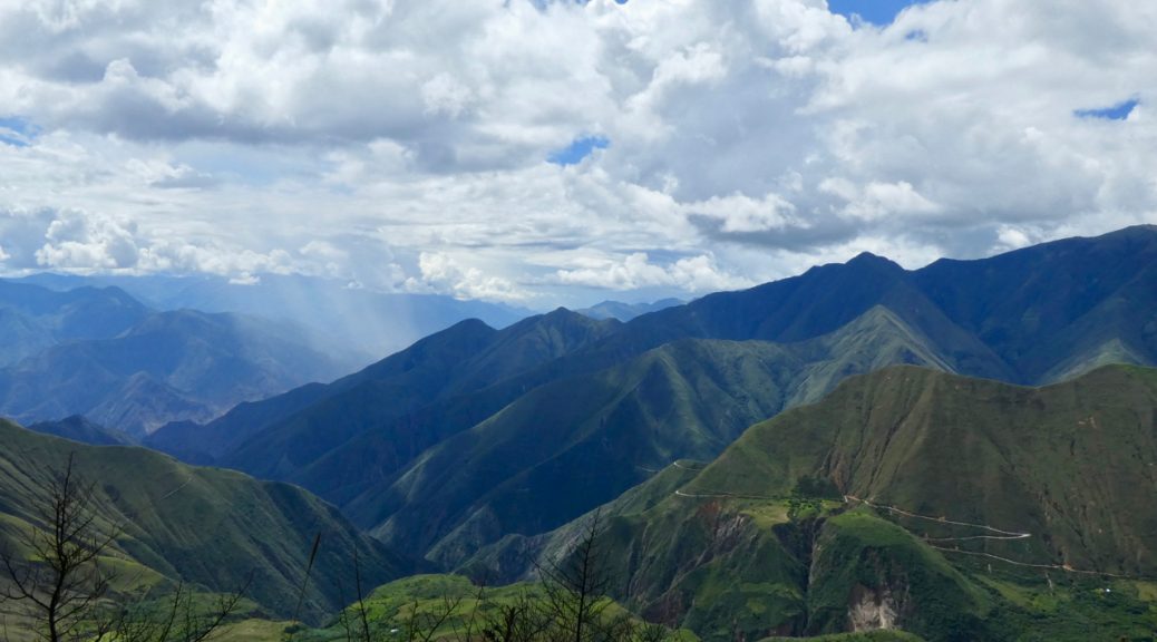
After we’d survived the crossing of Mordor, we were back on a mostly paved road although long sections were buried under mud and some bits partially blocked. The scenery as ever, continued to impress with it’s scale and grandeur.

Descending down into the canyon. Spot the cyclist!
Impressively big.

Eventually we reached the bottom of our 80km “easy downhill” road and the “town” of Chuquicara sitting at the bottom of the Canon del Pato. Chuquicara is a hot, dusty dump at a lowly 500m of altitude. The only accommodation was a really scungy restaurant/hospedaje ( other cyclists describe bedsheets that hadn’t been changed in months! 🙁 ). After eating a much needed but decidedly dodgy meal, we decided to give it a miss and despite our filthy, exhausted state, cycled on a further 20km and camped next to a sort of restaurant at the side of the road.

At the bottom of the Canon del Pato.

The following morning we set off up the hot canyon. After 20km and 300m of climbing we decided to get a lift. Michelle wasn’t feeling well, we were both very tired from the previous two days exertions and the canyon wasn’t living up to expectations. Other people/cyclists had said the canyon was spectacular to ride with 37 tunnels to negotiate and vast, towering walls of rock to slither through. We thought the previous days descent was pretty similar and didn’t regret making the rest of the journey to Caraz by bus.

We now have a few days here in the Cordillera Blanca before getting a bus to Lima and our flight home. We don’t know if we’ll do any more cycling now but we’ll see. Michelle appears to have acquired a stomach bug from the scummy restaurant in Chuquicara and currently isn’t very perky but we hope to try and do a couple of day walks or cycles to see some of the spectacular mountain scenery that makes this area one of the biggest attractions in Peru.

With any luck ( or not, depending on your perspective ) you might get another blog update before we leave Lima. If not, thanks for reading and see some of you in London! xxx
Torrential rain, trapped and tyred!

Torrential rain, trapped and tyred!

Hola chicos y chicas.

We’ve had a long gap mainly due to not much to report and difficulties getting good wi-fi and a mobile phone sim.

When we first started cycling together back in 1989, there was no email, no internet and no mobile phones. When we set out to cycle in Africa, my family thought I was actually on the way to China ( the Tianamen Square massacre scuppered that plan ) so the first thing they knew otherwise, was an airmail letter from Nairobi! It was a very satisfying feeling to know that no-one knew where you were and you felt that you were having a proper adventure.

Gaps in communication of several weeks were usual and people didn’t really worry; the normal way of communicating with travellers was via poste restante – You told people where you were heading and they then wrote to you i.e. Steve Willey, POSTE RESTANTE, Lilongwe, Malawi, where your mail would be held for up to a month. You then went to the main post office in your destination city, showed your passport and collected any mail being held for you. When you wrote back, your letter might get passed around or someone would make photocopies and pass them around. Simples. The system is still in use so maybe we should all abandon FB, blogs, etc. and resort to non-instantaneous old-school letter writing!

Anyway, we digress.

From San Ignacio our destination was the town of Chachapoyas, a four day ride away via very asian feeling paddy fields, a short cut we’d read about that involved a very turbulent river crossing from the “port” of Rio Maranon on the Utcubamba river and a wild-camp at a mosquito and sand-fly infested petrol station.

Paddy fields and palm trees – felt very Asian.
Pesticide spraying the rice sans any consideration for the workers lungs or health! 🙁
On the way to Rio Maranon.
The port of Rio Maranon!
Rio Maranon hyper-market.
A very rough looking river. We’re brave. We weren’t nervous! haha!
Peruvian super-ferry. Fare = US$1.80
hi-tech loading ramp.
Our petrol station camp spot. People are so nice though. When we asked for some water so that we could cook some dinner, the wife of the owner came along and asked if we’d like some rice – we said yes. A short while later, she called us up to the flat above the station and fed us a meal of rice, chorizo and eggs and refused to take any payment!

After our interesting river crossing, we pedalled on a further 80km through hot, dusty, countryside to the sleepy junction town of Pedro Ruiz Gallo where another bug struck and Steve had a very disturbed night! We’d been looking forward to continuing our cycle up the very scenic Utcubamba gorge but decided to feed Steve more movement-stopping drugs and take a mini-bus to Chachapoyas. The original plan was to leave Chachapoyas the following day and cycle 40km to the tiny village of Nuevo Tingo, the gateway to the ruined city of Kuelap. Plans are one thing, stomach bugs are another! Bug No2 confined us to town for 4 days whilst things took their course. Felt very sorry for Michelle getting bored stiff  – not exactly much to do except for a small cultural museum that contrived to be closed every time she went to visit. The only saving grace was the nice hostel we were staying in.

Peaceful hostel courtyard.

Once Steve was mostly recovered, we had an easy 40km cycle – 16km freewheel downhill followed by a lovely ride up a gently sloping canyon road to Tingo where we camped in the grounds of a hostel. The following day we left the bikes and our gear there and grabbed a lift 2km up to Nuevo Tingo where we took the new cable car to Kuelap. This new service takes 20 mins instead of a 3 hour hike! Last year Kuelap saw 40,000 visitors. They hope to triple that in the next year now access is easier although there’s still no airport in the Chachapoyas region so the increase in visitor numbers will be slow.

The fortress of Kuelap or Cuélap, is a walled city associated with the Chachapoyas culture built in 6th century AD. It sits at an elevation of 3000m and consists of more than four hundred buildings surrounded by massive exterior stone walls. The complex is situated on a ridge overlooking the Utcubamba Valley in northern Peru and roughly 600 metres long and 110 metres wide. It could have been built to defend against the Huari or others, but evidence of hostile groups at the site is minimal.

Some of the walls are decorated with tiled friezes in rhomboid or zigzag patterns which are a hallmark of Chachapoya architecture. The mural decorations include representations of the eyes of felines, snakes and birds, all different gods to the Chachapoya.
Kuelap round houses.
Frieze detail.
Bromeliads

One of the 400 or so round buildings on the site.
It’s not Machu Pikchu but very impressive nevertheless and in a great location.
Given that it’s one of the biggest archaeological sites in Peru, Kuelap doesn’t exactly have much in the way of tourist infrastructure or easy access – yet! The new cable car should eventually help to change all that.
New cable cars – only been running 4 weeks. You can just make out in the background the old hiking trail to the city that the cars replace.
Entrance way that only allowed one person at a time. As you can see, things are in need of restoration and are being supported in a typically Peruvian fashion.
More temporary support work….
Proper restoration work is badly needed.
One of the most interesting structures is the inverted cone-shaped tintero (inkwell). Pretty difficult to build with modern techniques and materials. Impressive for the C6th.


From Kuelap, we had another easy 50km day following the Utcubamba river up a pretty, gently sloping gorge road ( very reminiscent of small French alpine D roads ) to the small mountain town of Leimebamba where we stopped for the night before tackling our first big Peruvian climb.

Following the Utcubamba river.

From Leimebamba we aimed to spend 3 days or so cycling to Cajamarca, some 250km away. The first day saw us cycle uphill for 30km to a pass at 3600m – not too tough really except that we twice got attacked by bees ( no action on our part – just sudden unprovoked attacks! ) resulting in Steve getting stung 3 times and us dropping the bikes on the road, running away and then sneaking very, very slowly back to get them once the bees appeared to have gone away.

Looking back down at Leimebamba sitting in a fold in the mountains at 2000m.
The pass above Leimebamba.
Stunning views on the other side of the pass made the effort of the 1600m climb and the bee stings all worthwhile.
The view took our breath away. Photos really can’t capture it.
The valley floor in the foreground was maybe a 1000m below us. Our destination was the town of Balzas 2800m lower down.
Awesome.

The 64km, 2 hour freewheel down to Balzas in the valley was excellent although the increase in temperature not so excellent. 17C at the top and a sauna steamy 40C at the bottom. We’d read from an overland travel blog that there was a good wild-camping spot 5km on from Balzas; 200m higher up and in theory slightly cooler.  So once we’d fixed a slow puncture and some scumbag kids had stolen my e-cigarette, we left Balzas for our not so good as it turned out camp spot. Very rocky, very hot and very insecty. That’s a new word I just invented.

Our not so good wild-camping spot.

The following morning the alarm went off at 4:50 and we were on the road by 6:30 in a bid to try and gain a bit of altitude and cooler air before it became unbearably hot. The target for the day was the town of Celendin, 55km away and over another 3200m pass – 2100m of climbing ahead of us.

After a 1000m of climbing we or rather Steve gave up and we got a lift to Celendin and then from there, a mini-bus to Cajamarca.

We’ve been on the road for 3 1/2 months now. The cycling has been very rewarding, the countries and people experiences sublime but, we’re tired. The 2500km of cycling we’ve done so far has been very physically demanding at times and we’re now running out of energy.

We’d like to cycle a bit more – up into the Cordillera Blanca and on to the city of Huaraz where we plan to get a bus to Lima for our flight home in a couple of weeks – but have a couple of issues to contend with.

Some of the roads are very tough with some 4000m passes however, the main problem is due to the extreme rainfall northern Peru has been experiencing lately causing widespread flooding, mud slides and chaos.

There are currently no buses running from either here in Cajamarca or Huaraz to Lima because the rain has destroyed several critical roads and bridges or blocked them with mud slides! The main coast road north from Lima is closed causing major problems. 80 people have died so far, 140,000 homes destroyed or damaged and at least 650,000 people displaced or affected! Additionally, as a result of the transport issues, some food prices have increased or dropped because people can’t export their produce and fuel shortages and associated price increases are affecting some areas.

The road from Huaraz to Lima was open briefly a couple of days ago but further heavy rain has closed it again with more forecast for the next 2 weeks!

We may well be stuck and there’s a possibility that we won’t be able to get to Lima in time for our flight home!

At the moment the plan is to take a bus a bit further south then cycle the remaining 500km to Huaraz and hope that the situation improves enough over the next 10 days to allow us to get a bus to Lima.

What we don’t know is – will the roads re-open in time and if they do for how long? how many other travellers are stuck in Huaraz and will there be space on a bus if the roads do re-open? We’ll be cycling on some very tiny, high, remote dirt roads that themselves may or may not have rain-related issues. Exciting!

Watch this space!

Goodbye Ecuador, hello Peru and proper mountains!

Goodbye Ecuador, hello Peru and proper mountains!

Hola blogistas. Yep we’re still alive: some of you were worried at the lack of updates so here you go.

As you might have guessed from the title, we’re now in the land of marmalade eating bears and real mountains. Apparently, so said an Ecuadorian, Peru has proper mountains which implies that Ecuador and Colombia don’t, that we just imagined pedalling glacially up all those bloody huge hills and well, we probably don’t want to think about what’s to come.

In our last instalment we were just about to set off to circumnavigate Volcan Chimborazo, an inactive strato-volcano; the highest mountain in Ecuador (6263m) and also the highest in the world! Really! it’s true! According to the Ecuadorians, and probably a geologist or two, Chimborazo sits on the equatorial bulge which makes its summit the furtherest point on the Earth’s surface from the Earth’s centre and therefore, the highest mountain in the world. So there!

After leaving Latacunga, we made it 40km down the road to Ambato where we had to abandon the cycling due to us both feeling a bit off. After a day slothing in an hotel room (we call it recovering), the road from Ambato at 2500m, wound gently up through a gorge to 4000m into more landscape reminiscent of the Scottish highlands where we ran out of steam and semi-wild camped in a field after asking the farmer and giving him a $2 donation.

Could be Scotland or the Lakes except for the 4000m altitude.
Our portable hotel ready for occupation.

The next morning saw Chimborazo revealed through the clouds as we cycled onwards and upwards towards it and its Vicuna peppered national park.

Chimborazo drawing us ever closer.
Getting closer with Michelle cycling away as she thinks it makes a better photo…!
Vicunas
The Vicuna is a relative of the llama. Vicuñas produce small amounts of extremely fine wool, which is very expensive because the animal can only be shorn every three years, and has to be caught from the wild. When knitted together, the product of the vicuña’s wool is very soft and warm. The Inca valued vicuñas highly for their wool, and it was against the law for anyone but royalty to wear vicuña garments; today the vicuña is the national animal of Peru and appears in the Peruvian coat of arms. They have cute babies too!

Eventually we reached the official park entrance at 4350m. Whilst we were recovering and debating whether or not to try and cycle up the 8km dirt road to the Refugio and its campsite at 4880m, a local offered to take us and the bikes up ( for a small fee of course ) in the back of his truck. Feeling a bit apprehensive about the idea of camping at almost 5000m ( hey, what’s the worst that can happen? Death by hypothermia!?), we accepted his offer.

GPS altimeter seems to be a little bit out.
The camping area was another 20m or so higher than the Refugio. Had to recover a bit of breath after pushing the loaded bikes up.
Altitude. What altitude! He’s a hero.
Ice-encrusted tent in the morning with down-encrusted occupant reluctant to leave it. Thankfully, our sleeping bags were excellent again.
Stunning views from even higher up. Michelle was the hero with the camera, energy and lungs to climb further up the mountain!
Andean fox.

The following morning we cycled ( freewheeled 🙂 ) 50km downhill to Riobamba where we caught a bus to Loja in the South of Ecuador in order to save time and press on to Peru as our time left is dwindling.

From Loja we cycled to Vilcabamba, a weird little town colloquially known as Gringocabamba due to its population of white, 40 to 60 something Americans. Fortunately, just outside the town is Rumi Wilco ( https://www.rumiwilco.com ) a private 40ha eco-lodge and nature reserve that forms a part of the buffer zone of one of the world’s most biodiverse areas (Podocarpus National Park).

We spent a couple of days here camped in the forest by the river; walking the trails and generally enjoying its peace and tranquility.

Vilcabamba. The sign says: The only place in the world where it’s possible to give more years to life and more life to years! It is a common destination for tourists, in part because it is widely believed that its inhabitants grow to a very old age. Locals assert that it is not uncommon to see a person reach 100 years of age and it is claimed that many have gotten to 120, even up to 135, which would make it an area with the oldest inhabitants in the world. It is often called the Valley of Longevity.
Cycling out of Rumi Wilco on one of its trails.

A pitcher plant we think.
Colourful shield bug.
Don’t know what the plant is but the vibrant blue flower is lovely.
One of the several species of Orchid we saw in the reserve.
Spiky tree.
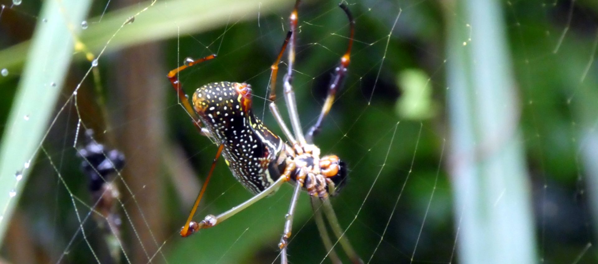
Awesome spider! Sorry for the shock all you arachnophobes! 🙂
More spider!
Wasp nest.
Transparent winged lacewing.
Camped in the forest.
Forest loo and shower!

The plan was to cycle the 150km from Vilcabamba to the quiet, non-tout, non-scammer occupied Peruvian border at La Balza however, after 20km and 850m of climbing, Steve ran out of steam so we decided to take a bus to Zumba, 117km up the road. We were glad we did. The road was extremely lumpy as in climbs of 800m+ followed by drops of the same and repeated many, many times! It might have taken us 4 days or more to do it as it’s unpaved for a large section.

After a night spent at the insect infested Hotel Emperador, we invested $20 in a private taxi to the remote border crossing shacks at La Balza rather than wait until mid afternoon for the $2.50 “Ranchero” bus/truck Ranchero bus.

On a roll with non cycling transport we then took a taxi the 47km to San Ignacio where we’re ensconced in the best hotel in town ($20 a night for a very nice double room! ) prior to heading off on the bikes tomorrow to Chachapoyas region and the monumental ruins of Kuelap, a C6th walled city that is apparently almost as good as Machu Picchu but without the hordes of tourists due to its location well off the beaten track.

The Ecuador/Peru border “town” of La Balza.
Steve cycling over the bridge and international border to Peru’s La Balza. When he went to the customs office, the official said he was going to lunch and sent Steve to the office to get his passport stamped. i.e. no customs!
Huge butterfly on the wall of an army post on the way to the border.
Butterfly detail. Amazing!

Ecuador has been interesting and fascinating but our 4 weeks there didn’t seem long enough to give us a proper feel for the country or its peoples but such are the constraints of travelling with time limits.

We only have a similar amount of time here in Peru so we may come away from here feeling a bit dissatisfied too! We’ll have to see.

Our first impressions of Peru have been good. Friendly, laid back people. It definitely appears to be much cheaper than Ecuador. We had a successful introduction to Peruvian beer but our first Peruvian meal was a bit of a failure! We thought the explanation of the meal might have been “Carne seco” dry meat, and what we got was literally dry meat – strips of meat, tougher than biltong served with a pile of fried banana strips – probably more akin to old boot leather. Notes taken to avoid in future!

Peruvian beer in our posh hotel.
Not exactly an inspiring meal!
He’s really enjoying his sole of boot….

Hasta luego for now!

Ciclistas, Cotopaxi and more bloody cobbles!

Ciclistas, Cotopaxi and more bloody cobbles!

Hello.

We thought the we might be at the Casa de Ciclistas for two or three days but broken bicycle and mechanic work load meant we were there camping in the garden for 6 days!

The Casa de Ciclistas, just outside Quito, is a rambling old hacienda-style house with an orchard, run by friendly Ecuadorian bike mechanic Santiago and his family. They have been providing hospitality for cycle-tourists for the last 25 years! We were keen to stop by as it was an opportunity to meet other cyclists, hear their stories and pick their brains about route ideas.

As it happens, Steve’s rear hub had a serious mechanical issue necessitating an emergency 15km cab ride ( both bikes sticking out of the boot! ) to the Casa. Steve’s mechanical issue required a new hub ( it had done 18000km and the Colombian/Ecuadorian roads just finished it off.. ) and the wheel to be re-built. A visit to the “Casa” was a timely event. Apart from getting the bike fixed, we met some great characters, went to a party and visited Quito.

The “Bunker” a dim, concrete cellar where the ciclistas keep their bikes, cook their food, talk about all things cycling and draw or write messages on the wall.
Santiago A.K.A The Godfather of cyclists in Ecuador, busy at work.
Michelle wanted to clean her bike. Santiago insisted that she virtually strip the whole bike and do a proper job! Steve decided not to get involved with any cleaning.
A creatively painted bike owned by Pancho, one of the Argentinians’.
Another bike with a creative pannier solution.
Benoit, a French cyclist chilling with Atti, one of the Casa hounds.
Jaime, an Argentinian cyclist working on his bike.
Jaime and Letty from Belgium in the bunker!
Pancho, bike mechanicing.
Group departure photo for a couple of French cyclists.
Leajandro, yet another Argentinian cyclist enjoying himself at the party. He also makes great pizza!
Danny and Ana, Santiago’s daughter after several shots of a potent sugar-cane derived spirit.
Gabi, another Argentinian cyclist and great character. He’d been there two months working as Santiago’s assistant to earn himself the bits to build a new bike with which to continue his journey.
Steve making friends with Atti. He likes cats really but can’t say no to the odd friendly dog! Don’t tell Ziggy!

So, after 6 lovely restful days we wrenched ourselves away from the Casa and continued our journey south with Cotopaxi national park as our next destination at the end of yet another vertically steep cobbled ( what is it with the Ecuadorians and bloody cobbles?! ) Ecuadorian road.

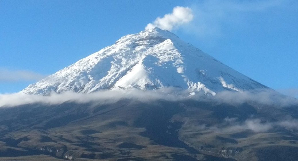
Cotopaxi volcano. 6000m high and normally shrouded in cloud but revealed especially just for us.
Bikes propped up next to one of the many huge rocks ejected by the volcano. Wouldn’t want to be in the vicinity when they were raining down!
Back on the road again. A happy cyclist with a cloud covered Cotopaxi in the background.
Another view of the majestic Cotopaxi.

We thought the landscape looked a bit like Scotland ( mist, cloud, rain and big empty beautiful landscapes ) except for the 6000m volcano obviously!

We’re now in Latacunga planning to get up close and personal with Volcan Chimborazo by cycling around it and up and over a couple of 4000m + passes.

Hello Ecuador!

Hello Ecuador!


The 8 weeks we spent in Colombia exceeded our expectations. When we arrived we had many trepidations lurking in our heads but the subject of remote roads with bandits, revolutionaries and heavily armed coke merchants all wanting a piece of freshly arrived gringo seemed to pop up more often then others.

All our worries were for nothing! No-one tried to rob, kill, kidnap or rip us off and at no time did we ever not feel safe. The Colombians are the nicest, friendliest, most welcoming, enthusiastic and easy going people ever. The country is brimming with cultural and natural beauty and is definitely worth a visit.

Ecuador. A new country.

Tiny Ecuadorian women in traditional dress tilling the fields; tiny dirt roads winding through vast vistas of Frailejones set in an astounding surreal landscape surrounded by huge mountains and volcanoes towering over two insignificant cyclists; strange money called dollars, steep, steep cobbled roads, and a million other new things.

Hello Ecuador!
Turn left when you see that mad dwarf with a rifle.

So, our first destination was the Paramo del Angel, a high altitude reserve with vast swathes of frailejones. Several blogs tried to give instructions on finding the start of the road with most saying to look for the mad dwarf statue above and to take the road fork nearby.

The Yorkshire dales with extra mountains.

The first part of the climb passing up through some local farms, felt a bit like the Yorkshire dales except for the diabolical dirt road and 5000m volcanoes looming in the background!

We soon left the farms behind and climbed up into the paramo with it’s beautiful landscape of frailejones and other paramo specialised plants. and no sign of habitation. Very peaceful. We saw just one vehicle all day. It was a nice gentle gradient too taking us up to 3800 metres to camp at a Refugio. Our sleeping bags did us proud.

And they said the roads would be better here.
The National Geographic map says this is a paved main road….

Our map says that the road through the Paramo is a paved main road; the reality is somewhat different! However, we had done our research and knew that there was no tarmac involved.

The road wasn’t all bad. What a place!
Textures
Spikes.
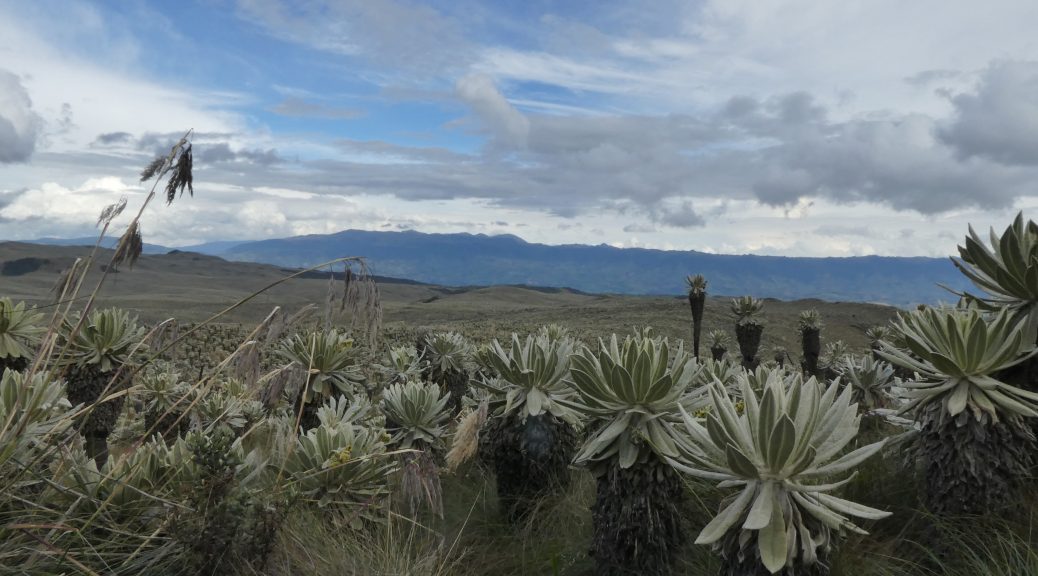
Frailejones – strange plants with leaves that are as soft as a cat to stroke.


The photo’s can’t really do this justice.
Just….

Getting ready for dinner at 3700m
Someone was a bit reluctant to leave his down coccoon.

Our 2nd day of cycling in Ecuador introduced us to two new Ecuadorian  cycling challenges. Cobbled roads and steep gradients beyond belief. And we thought Colombia was vertiginous. Clearly it was just a warm up! Cobbles and steep climbs means 70 km is well adequate for the day and sometimes 30 is more than enough. Passing through some small villages we were beginning to get a feel for Ecuador. Weird town statues, diminutive women in traditional clothing of embroided white blouses and elaborate necklaces and other jewellery, public toilets, election campaigning, (elections were last Sunday) advertising for shaman’s and all the time, these enormous volcanoes and mountains towering massively in the background, appearing and disappearing amongst cloud and giving us glimpses of snow glinting way up above our paltry 2700m.

The Ecuadorians seem to like their statues no matter what the subject!

Otavalo and its Saturday market has been on the tourist circuit for decades as a place to buy traditional textiles and weaving. The idea of tourist hordes tends to make us cycle screaming in the opposite direction so we decided to stay in an interesting hostel in a village on the outskirts. It was in a lovely natural setting and had real indigenous vibe with beautiful weavings decorating the rooms and the exciting opportunity to try ceremonies like hot stones and mescaline!


A little dome in the grounds of our hostel where one can go to do mescaline….
Inside the mescaline dome.
Hostel art
More possibly mescaline related weird hostel art.
More hostel art
Impending election.
A little cute encounter.
Looks like Ecuador will stun us with it’s wildlife too.
More electioneering.
Weaving with a heavy barrow of weaving.
Otavalo textile.
More Otavalo textile

Our choice of destination after Otavalo was a bit of a mistake in terms of the effort required both arriving and leaving! A cobbled climb on the steepest road yet, led us to Lagunas del Mojanda at 3800 metres, a couple of serene lakes set in a volcanic crater. Several blogs mentioned the Lagunas as well worth a visit. Clearly they are the blogs of super cyclists whose league is well beyond us and who are extremely skilled at omitting crucial information about the route or are simply just too embarrassed to admit they nearly died too. The lakes and their volcanic setting were beautiful  and yet again, the rain-god decided it couldn’t be bothered ( we seem to be doing quite well on the rain front ) but the climb of 1200metres over 12km on cobbles was pretty tough. Our total distance that day was 24km! We put up the tent and died. Later on, the clouds cleared to leave a clear, light pollution-free night sky, filling the crater’s roof with a stupendous display of stars.

Los Lagos de Mojanda
Free campsite at Los Lagos de Mojanda
Lagos de Mojanda

The next morning we discovered further aspects of why our trip to the lakes was a bit of a mistake. The climb up out of the crater side was literally impossible for us to cycle. We climbed 330 metres in 2.5 km to just over 4000m on a typically vertically steep Ecuadorian dirt road. We pretty much pushed the whole way – not exactly what you want at any time let alone first thing in the morning! The 15km descent on the other side was an equally horrible experience just slightly mitigated by the relief that we weren’t coming the other way.

Us with Valentin, the owner of a friendly family campsite virtually on the equator.

Our first week in Ecuador has been fun, interesting and challenging. We’ve crossed the equator, learnt about cobblestones, why the pre-columbians didn’t invent the wheel and adapted our bodies to more fried food.

Corny equator pose.

We’re now ensconced in the “Casa de Ciclastas” , just outside Quito, a sort of house with free camping for cycle-tourists run by Santiago, an extremely generous Ecuadorian cyclist and bike mechanic. We plan to stay here for a few days as we have to fix Steve’s broken back wheel again, ( this time the roads have broken the axle or the hub – we don’t exactly know yet ) do the usual shopping, laundry, ATM duties, etc. and visit the historic old centre of Quito for a quick dose of tourist.

Ps. Have cycled just over 1800 kms so far. Hope to do another 1000km before the end of the trip!

Friends, Frailejones, and a beautiful trampoline of death.

Friends, Frailejones, and a beautiful trampoline of death.

Hola! Back again.

So, we survived the the Trampoline of Death but more on that later!
After Salento, (hummingbirds, wax palms and more chilling) we cycled to Armenia to stay with Karen and Jorge. Karen is an old friend of Michelle’s who she last saw 34 years ago when they were exchange students together in Mexico! Karen now lives in Atlanta with her husband Jorge a Colombian but they also have a house in Armenia that they frequently visit and invited us to stay. It was great to be looked after and shown around.

Karen, Jorge and us.
Drying coffee beans by the side of the road.
Coffee beans on the bush.

They took us to see more great coffee towns in the mountains and their cowboy culture; we felt very spoilt to be chauffeured around without having to toil up hills on our bikes. They also took us their friend Alexander’s house, where he was having a birthday party for his 5 year old girl – we felt somewhat underdressed for this lavish event at his amazing house with it’s stunning views and infinity pool!

Birthday cake and edible extras!
Michelle and Karen at the party.

We decided to take the bus from Armenia to Popayan, known as the “White City”, to cover some ground and avoid cycling on truck and bus infested roads through a hot valley; Jorge and Karen were amazing again and took us and our bikes to the bus station where we said our goodbyes.

We didn’t really give Popayan much of a chance but decided to go on a city tour. Terrible! Not the city, the tour. We abandoned it early on the pretext of having to catch a bus. Felt a bit sorry for the guide for dropping out of the group but listening to someone read Google’s privacy statement would have been more interesting…..

Popayan main square.
Bohemian bar and huge record collection in Popayan. It’s not all cycling!

Our route from Popayan took us over the mountains on more quiet, rough dirt roads to San Agustin and it’s archaeological park. It contains the largest collection of religious monuments and megalithic sculptures in Latin America[1]and is considered the world’s largest necropolis. We did think about paying for a guide but the little museum tells you all there is to know which isn’t much as no-one really knows who these people were or what it was really all about and apparently the guides just repeat the same stuff and have no answers, just speculative waffle!

It was very quiet and peaceful with few visitors, probably because it’s quite away off the normal backpacker/tourist trail; the park is beautifully laid out and a pleasure to walk around although we were reminded that we weren’t in Hyde park when Michelle saw a snake ( I didn’t but wished I had! ) and had a bit of a drama queen moment.

San Agustin sculpture – love the teeth!

The road to San Agustin took us up over 3000m and into the Páramo ( Páramo generally describes an area above the continuous forest line (3000m), yet below the permanent snowline ) typified by Frailejones, a weird looking plant that only grows in this environment. Related to sunflowers they capture water vapour from passing clouds in their spongy trunks and release it through their roots into the soil.

Frailejones

Had to wild camp on the way to San Agustin and ended up camping on a school football pitch! Once again we were amazed at the helpfulness of the Colombians – a teacher from the school and her friend came back after dark with coffee and arepas for us as they were worried about us being cold and hungry!

Camped on the school football pitch! Perfect. Proper loos and running water.

From San Agustin we continued heading south towards Ecuador. We had to again climb up over 3000m and drop down into the Amazon basin where it became very hot, very sticky and very jungly. The dramatic change in vegetation  and the stunning variety of birds, butterflies, insects and their crazy cacophony of noises made up for the super sweaty cycling! Awesome downhills on sealed roads also meant awesome velocities! 🙂

Amazonian bird and its odd call.

Makes all the effort going up worthwhile! 🙂
Some kind of weaver bird nests.
Cycling in the jungle.
Early banana stage.
Strange cross-valley transportation….
Machine to crush sugar cane and turn it into juice.
Something to consider in the jungle!
Waterfall walk.
Free-range chickens.

The Trampoline of Death!

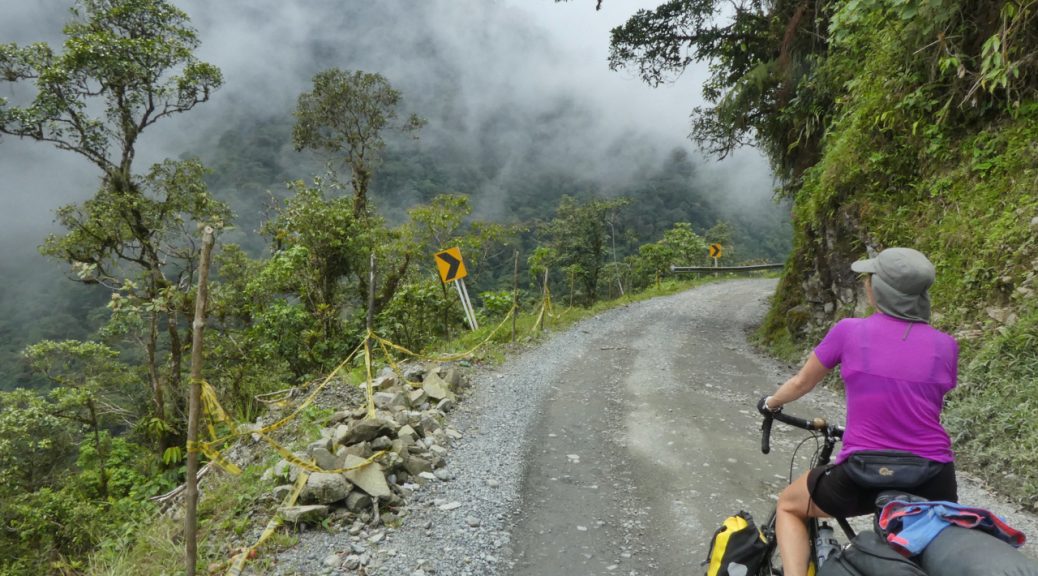
The road from Mocoa to Pasto takes you up out of the Amazon basin (450m up to 3200m) via El Trampolin del el Muerte, Colombias’ answer to Bolivia’s Yungas death road. This precipitous, narrow, unstable gravel road has several rivers literally flowing over it and is notorious for lots vehicles plunging off it either whilst trying to squeeze past each other or simply when the road edge gives way and they plummet screaming over the edge. It also has a reputation with cycle-tourists for its tough, steep climbs over 4 high passes, stunning scenery, lack of places to stay and torrential rain.

Looking back down at our winding road.
Heading up through the clouds.

We were somewhat nervous when we set out but decided to simply try and enjoy the experience and not worry about the potential pitfalls…. Not long after we set out, we were caught up by James, the first other cycle-tourist we’d seen. James talked about having averaged 160km a day so far and said he’d thought he might get to Pasto in one day. Bloody hell! We were planning 3 days. Given how tough it was, we suspect even James had to scale down to doing it in two. We’d like to think so anyway!

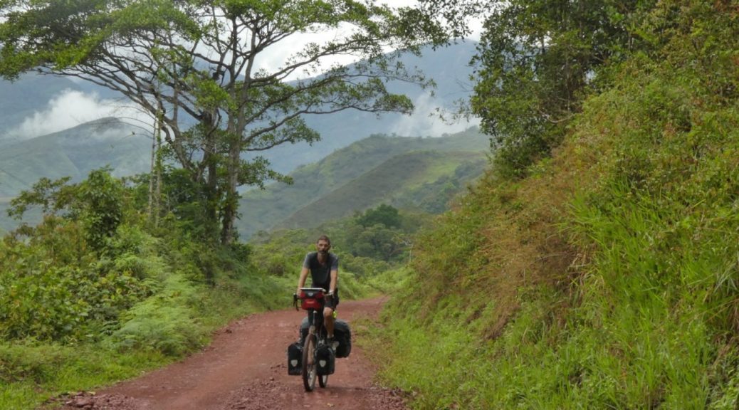
The tarmac ended after 15km and the steep, rough, river-fording 1750m dirt road climb to the first pass pretty much did us in however, the scenery on the way up was amazing with views of the winding road far, far below, appearing and disappearing through the clouds as we climbed through them. Descending after the pass, we considered cycling on but decided to  camp on a patch of grass by a restaurant just as heavy rain started. Good thing we did. The following morning we cycled for two hours without seeing anything remotely suitable for a camp spot. This is really wild and remote country. The next day was equally tough, equally remote and just as rewarding but this time had an hotel and a hot shower waiting at the end of it. 🙂

Beautiful scenery on The Trampoline of Death.
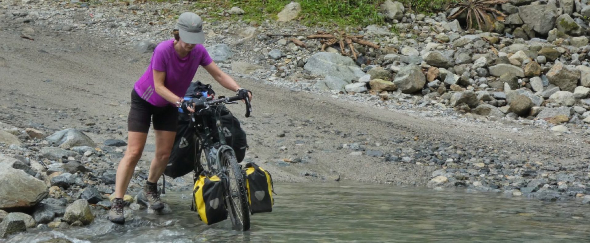
Intrepid river fording on The Trampoline…

A bit of the road that actually had crash barriers!
Winding, treacherous and beautiful.
Butterfly and boot.

Day three took us on a sealed but tough road over another 3200m pass and more Frailejones, to Laguna de la Cocha where we camped for free at the idyllic Hotel Jardin Del Lago sitting just above the lake.

Idyllic free camping at Jardin del Lago
Dusk over Laguna de la Cocha
A another couple of cyclists and their dog in a basket on the back!! heading the other way to the Trampoline and Mocoa.

Tomorrow we leave Pasto and head for Ecuador!

On our way to the Trampoline of Death….

On our way to the Trampoline of Death….

Hello bloglets!

Have been off the radar for a bit but we’re still alive!

Currently down in the Amazon where it’s hot, steamy, and jungly.  A zillion little beasties are queuing up to drink your blood and the hotel has the worst wifi ever.

We’re heading back up to the mountains and on towards Ecuador via El Trampolin de la Muerte.

Going to be off the radar again for another couple of days but will hopefully be able to do a proper update once we’ve finished trampolining…..

S & M.

Vertical coffee and coloured houses; Medellin to Salento

Vertical coffee and coloured houses; Medellin to Salento

Blog writing is hard. Probably all writing is hard especially when one is rubbish at it and is trying to make things non-boring and interesting…..   Anyway.

As ever, leaving cities sucks! After 5 days in Medellin we were glad to be leaving.  The ride out during morning rush hour was pretty awful though;  Trucks and busses squeezing past with inches to spare, motorbikes and scooters zooming past on all sides and every vehicle belching out clouds of toxic fumes and smoke.

Medellin sits in a valley and is surrounded by steep hills on three sides with five main exits from the city and all but one of them necessitate a climb of at least 15km – unfortunately we didn’t choose the “all but one” however, once we’d escaped the worst of the traffic, the climb out actually wasn’t that steep and was alleviated by a random motor cyclist stopping us and demanding that he buy us coffee and let him take photos of us! We couldn’t really refuse – as it turned out, Freddy is planning his own long distance South American trip and wanted to simply talk to us to find out how our Colombian cycling experience had been so far.

Our first days cycling on the Pan-American highway was as horrible as expected although the 60kmh, 10 mile zoomy descent after the big climb was fun but then it was just heat and huge trucks for a whole day until we reached the hot, steamy mosquito infested town of La Pintada and its expensive campsite. No more Pan-American if we can possibly help it.

The following morning we left the Pan-American and headed into the hills of coffee country. Expecting a sealed road all the way to Aguadas our destination some 45km horizontally and 1700m vertically away, we were crushed, disappointed and mightily pissed off when the tarmac disappeared and we unexpectedly found ourselves crawling up an 800m climb on a hot rough dirt road again. Thankfully, after a couple hours, the tarmac reappeared and our biggest challenge became completing the remaining 1100 metres of climbing surrounded by coffee and banana plantations set on almost vertical slopes; some of them so steep it seemed like a mountain goat would have struggled let alone a plantation worker.

Aguadas, a small mountain town sitting in the Caldas Coffee Culture Landscape – a designated World Heritage Site – is mainly interesting for its Aguadeno hats ( http://www.palmato.com.co is a fair trade business supporting local hat weavers, traditional skills etc) handmade from fibres of the iraca or shawl palm, grown and processed in the region.

Then more hills and coffee country and more 1000m+ climbs ( imagine climbing Mt Snowdon every day and you’ll get the idea ) although now almost completely on sealed roads which makes life much, much easier; the next day to Salamina, another attractive, historical town and the next day to the odd but attractive town of Neira with its 5 pool halls in the space of two blocks! They must be national if not world champions.

The next couple of days took us back onto the dreaded Pan-Am’ highway – the first day was like our previous experience:  absolutely diabolical with huge trucks and busses roaring past, the sweltering heat adding to the misery and our destination of Santa Rosa de Cabal wasn’t much better with crowded, polluted streets, gangs of Punks as in Mohican-haired, safety-pin attired Punks and lots of rough looking people wandering about. Conversely though, another local asked for photos of him with us and the bikes and then gave us a huge melon!

The following day on the Pan-Am’, a Sunday, was a pleasant surprise with very little traffic and dozens of local lycra-clad cyclists giving us shouts and waves of encouragement and people stopping in their cars wanting to have photos of themselves with us and our bikes.

Salento our destination for the day ( 1400m of up and 1300m of down ) is uber touristy and not our thing at all however, the eco-farm of La Serrana, where we’ve been camping for the last 5 days has views to die for and its altitude of 2000m is just perfect with warm days, cool nights and lovely walks in the hills dotted with wax palms and little humming bird sanctuaries hidden in the forest – it’ll be a real shame to leave here tomorrow but we must press on.


Sunday cyclists out for a spin. We saw more than 50 cyclists this one day. Cycling is a BIG national sport


Meeting Freddy on our way out of Medellin.


Gaseosas (Softdrink) stops keep us going up the hills.


Salamina, a town in the clouds.


Coffee finca, with bananas


Colourful transport


Hats in Aguadas


Retired cowboys in Aguadas town square… 😀


Veg shop
Fab camping spot in Salento


more gorgeousness from the door of our tent.


Sunset in Salento


More Salento sunset from the back of our tent.


Colourful houses.


Saw a couple of these signs in the coffee country. ……….


Salento town square


Wax Palm’s – https://en.m.wikipedia.org/wiki/Ceroxylon_quindiuense


Wax palms.


Mountain walks.


Humming birds


Mooching in Medellin.

Mooching in Medellin.

Hello.

Have been chilling in Medellin for the last few days and having a very sociable time at the Black Sheep hostel. Good to meet some Americans here making a special trip back to the States to protest at Trump’s inauguration.

The city is surrounded by extremely steep hills and feels modern – lots of urban regeneration and a big turn around since the bad days of the 90’s. We did a city tour and like in Bogota, our guide was passionate about the history and culture of the city/region and positive for the future. She referred to Pablo Escobar as ” this cities most famous criminal”. She was pretty negative about him as you would be if you’d grown up in Medellin in the ’90’s. They call themselves Paisa’s here and are a very proud people.

We had some more bike on transport encounters to arrive here. After a few more days of dramatic scenery and vertiginous climbs  on dirt roads/boulder strewn river beds following our last blog post, we admitted defeat for the last 30 km of unpaved road and had a great ride on a local bus with helpful driver. Did our first 85 km day on account of reaching the tarmac then lost 2400 metres of altitude to arrive in the steamy lowlands of the Magdalena river basin. This is the countries main river and since pre-colombian times a route to the interior.

Unfortunately the roads we connected with here were very busy and seething with monster trucks and busses so we decided to get on a bus for the final push to Medellin. We were a bit concerned about arriving in Medellin at midnight with a damaged bike (again) and 12 bags between us however, our fears were unfounded; the bus terminal is designed to prevent less well intentioned people from loitering and had a reassuring number of security people about.

We’ve made some necessary bike purchases here including picking up a very expensive DHL delivery of a part impossible to get here! – mucho thanks Andy from the UK machine company for his amazing help in getting it sorted.  Now heading off in to the coffee region and perhaps a bit more tarmac for a change but hopefully quiet roads.


A bit faint, but you can just make out the 2000m pass we were heading for at the top of the image.

Local denizen….

Young girl with pet parrot!


Bike laden bus.

Super helpful bus driver.


The Magdellana river.


Bikes on top of titchy taxi at Medellin bus station. No problem!


Sculpture in downtown Medellin.


Fernando Botero sculpture with working women……


Tempting snack.

Mari, our informative walking tour guide.


Detail from a sculpture about the history of the Paisas.


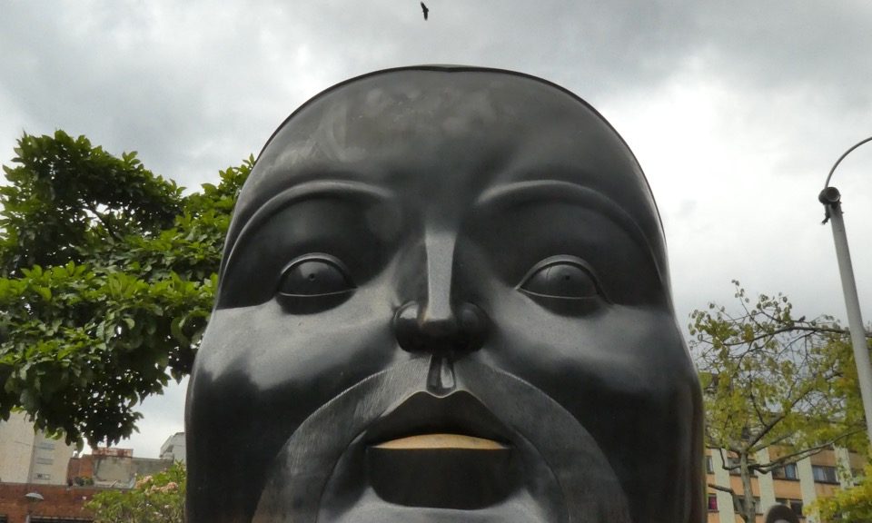
Love this Botero


Botero sculpture on the Botero plaza.


Another Botero.

Botero sculpture blown apart by a bomb in 1995 and left as a memorial to and reminder of the 22 people who died.


making friends with a hostel resident.


Some Google maps of our route so far:

https://goo.gl/maps/X3rBbpwY8tP2         Bogota to San Gil

https://goo.gl/maps/zxVdiCqse292             San Gil to Medellin.

Impressions, pitstop in Barichara, and back on the road

Impressions, pitstop in Barichara, and back on the road

Happy 2017 blog readers!

Spent the New Year period in the tranquil town of Barichara mainly chilling, drinking beer, swimming (yippee!) and oh yes, a day risking life and limb when we went paragliding!

We were somewhat nervous about the paragliding, especially on New Year’s day; both harbouring thoughts of hung over paragliding instructors forgetting something important and smashing us into the ground from a sickening height however, once airborne, we realised that we were just a couple of drama queens and our pilot was nothing but cool, calm professionalism! A totally amazing experience. 2,500m up, floating with the birds. Very peaceful and serene – possibly one of the best New Year’s day’s ever.

Now we’re back on the back roads again – still crawling along like arthritic octogenarian sloths, still cursing and swearing our way along rough roads and up 1000m climbs but still being blown away by the awesome scenery, clouds of rainbow butterflies, stupendous trees and a zillion different kinds of birds – hadn’t realised that there could be such colour and variety.

We’ve had such great interactions with Colombians. Cowboys on their horses, little old ladies pottering along country roads, farmers leaning on gates, people giving us mandarins as it’s mandarin harvesting season and there’s mandarins everywhere; People are generally so NICE to us. Curious about where we’ve come from, where we’re going and happy to help in any way. It’s probably a good thing we are traveling so slow. We’ve plenty of time to chat to passers by while we catch our breath (hope it’s not heart failure) on the climbs.  A bit weird cycling into some of the really small villages though – probably the first western cycle-tourists they’ve ever seen; plenty of WTF expressions on peoples faces and the whole village stopping and staring at the aliens that just teleported in.  🙂

Weather has been a bit of everything. Kind of chilly in Bogota and nice to have our down jackets which we’ve bought for the higher andes. Sun and rain, torrential thunderstorms and a lightning strike that was really bloody close, like a 100m away close! Knocked out the internet in our hostel in Villa de Leyva. Had to resort to talking to people!

Hot in San Gil and Barichara. HOT and really humid leaving Barichara. So hot we’ve had to get up at 5AM for the last couple of days!!! and cycle until about 10am then sit in the shade of a town square until 3pm then cycle for a couple of hours after that.

Heading for Medellin now so likely to be off the radar again for a few days so we’ll leave you some photos and some general impressions of Colombia so far.

Paragliding over Chichamocha gorge – Second deepest in the Americas after the Grand Canyon!


Michelle in the air.


Paragliding over Chichamocha gorge.


Paragliding over Chichamocha gorge.


Paragliding.


NYD by the pool.


Typical stone built church on every village square.


Lemon bird in a lemon tree.


Barichara church.


Tradition of working with stone is still strong.


Great juices in Colombia!


Many villages seem to have huge trees in their squares.


More mountain scenery.


Lovely mountain road.


Hardware store specialising in barbed wire and cowboy hats!


All the town squares we saw had a big neon light display of various Christmas related things however, in Barichara there were all these neon ants on account of them being a local delicacy!  Hormigas Ants!


Roads that aren’t roads and now travelling slower than a legless tortoise….

Roads that aren’t roads and now travelling slower than a legless tortoise….

Dragged ourselves  away from Villa de Leyva and headed for San Gil via the backest of back roads.

Day 1 to Gambita was a mixture of stunning scenery, interesting flora and fauna, friendly police, torrential rain, rough roads and riding into town in the dark to a “swanky” hotel with out the swank i.e. no hot water!


Day 2 was something else! We literally travelled 20km in 26 hours! We’d had trouble getting the gps to route us on a road that we knew to exist – it didn’t take long to find out why the GPS had more brains than us.

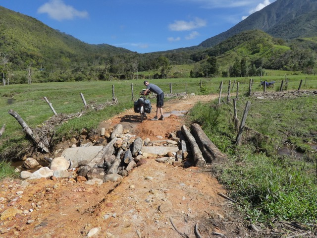
The “road” was really just a boulder strewn track hardly suitable for horses let alone two exhausted gringos on bicycles; 900m of climbing, 450m of descent, two broken spokes and a buggered rear derailleur. This is really remote country. We saw a couple of local trucks early on ( got invited to go fishing! ) and that was it.

After 8 hours of slog and 16km covered, we came across a basic shelter with a couple of people outside (turned out that they were from a nearby Dhaoist community) who said we could camp by their shelter.

Day 3. Struggled along with broken bike on a really broken road. Mainly pushing covering 4km in 3.5 hours.

Eventually reached a better road where we hitched a lift in a truck with our hero Rodolfo and his mate who took us to San Gil where we made repairs.

Camped at the “community”.


Crossing foot-suspension bridge – new bridge not built, river too deep to ford.

Our hero Rodolfo coming to the rescue!

The expression says it all!

Still had great views from the truck!

Lazy de Leyva

Lazy de Leyva

Villa de Leyva was lovely. It’s vast main square (14,000 m² – one of the largest in the Americas) was a great place to hang out, people watch and listen to the buskers – nice benches thoughtfully placed around the edge for resting and drinking beer 🙂

Villa de Leyva main Square

Villa de Leyva lookout.


Spent 4 days camped in the grounds of the very relaxing Hostel Renacer. Had a very sociable Christmas meeting people from all parts of the world. This hostel is a stop for overland trucks and other vehicles.

We met an American working on rehabilitating child soldiers and a French guy working on water conservation schemes in Bolivia – made a nice change from talking to spotty teenage backpackers.  🙂


Leaving Bogota and travelling slower than a tortoise in peanut butter.

Leaving Bogota and travelling slower than a tortoise in peanut butter.


4 days for two experienced cycle-tourists to cycle 160km! Easy…. Are we fit? NO! Are we altitude adjusted? NO! Was it easy? hahahahahahah……

The first 65km literally took us all day, with steep climbs, wrong turns and no oxygen. Cycling out of cities on nasty busy roads always sucks however, this was especially polluted, especially busy and especially sucky. Our campsite for the night though was anything but. Our WarmShowers ( CouchSurfing for cycle tourists ) host Daniel runs his own tiny campsite and gave us a beautiful free spot for the night; it was just a shame that we were rubbish guests and too exhausted to do anything but collapse in the tent and pass out.

Free WarmShowers camping spot.

Our plan was to take the back roads to Villa de Lleyva. That means no tarmac and STEEP gradients……. at altitude, with regular 2600 metres to 3000 metre climbs. The good part is that we get to see amazing views and Colombian rural life and hardly encounter any vehicles except for one notable exception.

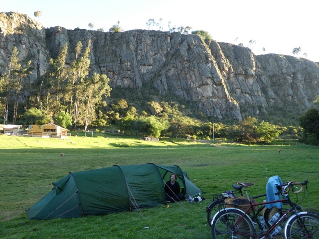
Our second night camping was another beautiful site; a campground by a rock climbers hang out. The new tent is proving to be excellent.

The notable exception to being on quiet roads was finding ourselves climbing up a steep gravel road between two towns between which coal trucks, multiple, multiple coal trucks were ferrying their load. Nightmare. Wheezing like steam trains anyway on account of the altitude and sucking in lung falls of coal dust. We were shattered at the next village.

Pushing…. And Steve never pushes.

Trucks, trucks and more trucks
Coal blackened and exhausted.

The next challenge was Steve waking up in the night with stomach related issues…..  The next morning the stomach and  Steve were worse. Faced with the choice of cycling sick on rough roads with big climbs or staying in a one horse town whose horse ran away, we decided to buy movement stopping drugs and cycle.

27 km later after 400+m of climbing and 800m of decent on a really diabolical road, we reached a village with taxis and more specifically, a taxi driver that agreed to put our bikes on his roof and drive us the last 20km to Villa de Leyva where steve crawled into the tent and tried not to die.

We’re now camped in the grounds of a lovely hostel where we plan to stay for the next few days with plans to head further north on Boxing Day.

And here’s a few more photos:

One of many great views.


Statue of a breast-feeding woman… Probably be banned in England.
Where 4 legs is better than 4 wheels?
Headless saint…
Plastic bottle xmas tree.


Chilling and exploring Bogota

Chilling and exploring Bogota

Went on a bicycle tour ( well, what did you expect? ) of the city with an excellent guide who gave us a broad overview of Colombian politics, history, art, architecture and culture combined with visits to fruit markets, coffee factories, street art spots and a game of Tejo that involves drinking beer whilst throwing heavy chunks of metal at a clay target that literally has explosives embedded in it. Points scored for hitting the target and explosions!

Tourist excursion up the mountain for spectacular night views of the city somewhat let down by an excess of very tacky illuminated festive/Christmas paraphernalia.

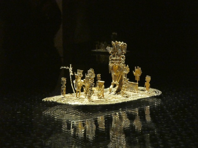
Excellent free visit to the Botero Art museum housing art by Dali, Miro, Picasso, Botero, Monet and Matisse to name but a few. Highly recommended if you make it to Bogota. Another excellent museum is the gold museum with a huge collection of pre-Columbian mainly gold artefacts. Astounding levels of craftsmanship and art, some of it produced more than a 1000 years ago.

We’ve also been busy researching our back country cycle tour of the Colombian highlands with the help of maps, local knowledge and google maps and street view. It is amazing what tiny dirt roads google seems to have got their car to drive along……… What a job.  A googled road…..


Llegado en Bogota! :)

Llegado en Bogota! :)

Knackered, shell-shocked and jet-lagged but here. Bikes in one piece. Everything that went on the plane came off it so all-in-all everything is currently hunky dory.

We considered cycling the 15km from the airport but couldn’t face it in the end….  Nice Taxi driver.

Initial impressions are- lots of street-art, friendly people and a big mountain right there overlooking the city with a cable car thingy and funicular railway going up to it.  We can see  it from our hostel window.


Stressed at the airport

Stressed at the airport

Travelling on planes with bikes is always very stressful. After thorough research Steve strongly feels that we should pack the bikes in clear plastic bike bags however our arrival at the airport invariably involves protracted discussion with airport staff about the suitability of our packaging. So here is a picture of Steve rigid with stress!  But we are sending this post from the PUB in the departures lounge having successfully put the bikes through the oversize baggage system and been assured that they will be carried by hand to the aircraft.  We can only hope.  For those cycle tourers amongst our friends other travel arrangements of note is that we pack all 8 panniers, tent, etc in two large bags  weighing 20 kilos each.  We’re so relieved to have checked in.  Fingers crossed for the bikes emerging unscathed at the other end. Time for another beer…..  ☺

Packing chaos….

Packing chaos….

Great night last night seeing friends old and new before we flee the dank greyness that is the British winter.

Test packing chaos is currently ensuing. So far our packed clothes are about 4kg each which isn’t too bad for 4 months away. Trying to get everything into 2 large bags for the plane. Wrestling with luxuries, electronics and camping gear now.

tmp_17079-img_20161203_142637-4478696


Hello

Hello

Hello.

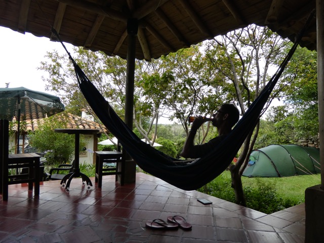
So, we’re off with our bikes for a 4-month cycle trip to South America! We fly to Bogota in Colombia on the 11th December and other than having return flights from Lima in Peru on 13th April, we have no real plans except to cycle, explore and hopefully have a few adventures along the way with a bit ( okay, probably quite a lot ) of hammock time to keep us chilled.

This will be our third trip to the Americas but our first visits to Colombia, Ecuador and Peru the and longest we’ve done for some 25 years.

We’ll try and keep you updated and hope you check back often to see how we’re doing.

Steve & Michelle xx